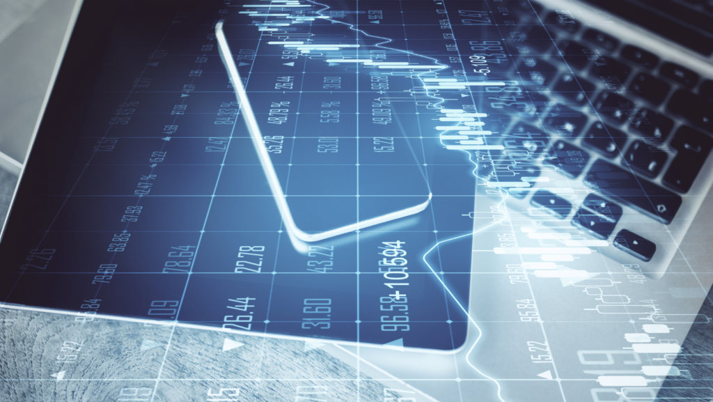
Not long ago, accessing orbital data was a privilege strictly reserved for elite scientists and government intelligence. Today, we are living through a massive paradigm shift. With over 1,200 active Earth observation satellites currently monitoring our planet, the commercial space sector has effectively democratized data. You no longer need a security clearance to analyze current satellite images; anyone with a laptop can now conduct serious analytical research. Platforms like LandViewer by EOSDA have transformed casual map browsing into actionable science for farmers, students, and everyday environmentalists.
More Than a Pretty Picture: How Satellites Actually See the Earth
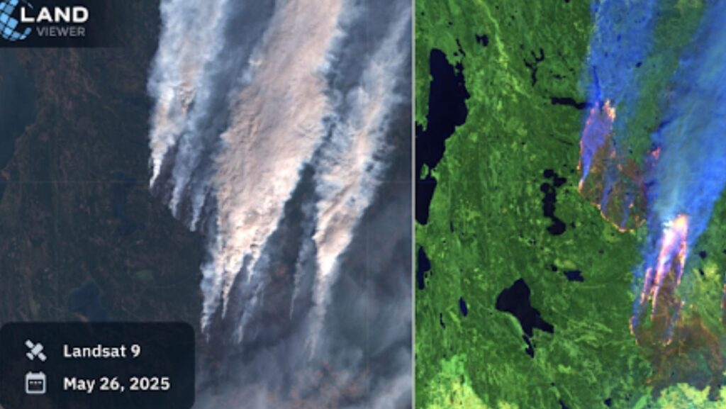
Systems like the American Landsat capture 11 distinct bands of light, while Europe’s Sentinel-2 uses 13 to scan the entire globe every five days. Advanced hyperspectral cameras go even further, slicing light into over a hundred unique channels and sometimes offering a live satellite feed online.
Why do we need all this data? Because the most critical changes on our planet are invisible to the naked eye. By measuring how objects react to electromagnetic radiation outside the visible spectrum, we stop looking at pretty desktop wallpapers and start extracting hard, measurable truth from current Earth satellite images. Every physical object on Earth reflects light differently outside the visible spectrum. Geoinformation software like LandViewer combines these monochrome channels into specific indices (such as NDVI for vegetation) to reveal conditions completely hidden from the human eye:
- Vegetation health: Actively growing plants reflect intense near-infrared light, glowing bright red in false-color images. This lets farmers spot silent killers like blight or pest infestations weeks before a harvest is actually ruined.
- Land classification: Sensor data clearly separates the hard concrete footprint of urban sprawl from vulnerable agricultural fields, creating an undeniable, overhead paper trail to track illegal construction.
- Water analysis: Specialized coastal bands literally pierce the water’s surface. This allows us to measure depth, trace toxic pollution runoff right back to its source, and monitor the safety of the drinking water sitting in our reservoirs.
What is LandViewer?
If you are wondering how to find current satellite images without a degree in astrophysics, LandViewer by EOSDA is your answer. It is not just another gallery of pretty space pictures; it is a full-featured, browser-based analytical hub. Trusted by nearly a million users globally, the platform analyzes over 96 million square kilometers of Earth’s surface every single month, pulling data from more than 45 different satellite constellations.
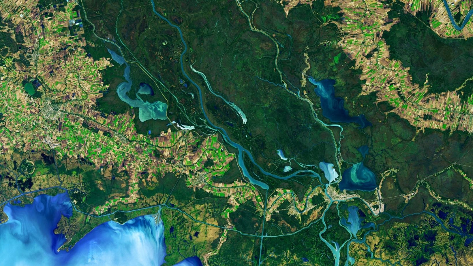
Whether you need a live world map satellite view to track rapid urban expansion in your city or historical data to monitor seasonal crop health on a family farm, this tool brings professional-grade Earth observation directly to your laptop.
Step-by-Step: Your First Satellite Analysis
Since roughly 67% of our planet is obscured by clouds at any given moment, getting a clear, usable shot from space is notoriously difficult. Here is how you can bypass that meteorological noise and start extracting hard facts:
- Filter the interference: LandViewer automatically strips away overcast scenes. By drawing your area of interest, the platform scans petabytes of archive data from providers like Sentinel and Airbus to instantly generate a clean, cloud-free mosaic of the most current satellite images.
- Expose the invisible: Standard photography limits us to the visible spectrum, but mathematical spectral indices, such as NDVI (Normalized Difference Vegetation Index), reveal hidden truths. Thriving crops glow neon green, while drought-stricken or diseased plants flash a warning yellow.
- Track the timeline: A single frame only provides a baseline. By using the split-screen comparison tool to match current satellite imagery against historical archives side-by-side, you can pinpoint the exact week a glacier retreated, a forest was clear-cut, or a new housing development broke ground.
- Export the proof: You can download high-resolution files, generate compelling time-lapse animations of long-term environmental changes, or feed a live real-time satellite view directly into professional GIS software.
Applications, Made Simple
Let’s step away from viewing satellite data as just abstract pixels on a screen. Today, it is a highly practical tool for solving urgent, everyday problems that affect our communities. Whether you are trying to figure out why a local reservoir is drying up or managing a massive global supply chain, pulling up a current satellite image fundamentally shifts the balance of power. You no longer have to guess or rely on official statements; you can see the truth for yourself.
Here is how different people are putting these tools to work on the ground:
- Agriculture: Feeding a growing planet is getting exponentially harder, with the UN projecting we will need 60% more food by 2050. Farmers aren’t just looking at dirt anymore. They use these platforms to monitor daily crop health, save precious irrigation water during crippling droughts, and instantly prove storm damage to keep their family farms afloat.
- Environmental Monitoring: We lose roughly 10 million hectares of forest annually, a devastating loss we can now track. Watchdogs and activists use a live satellite view of Earth to catch illegal logging red-handed, monitor coastal erosion, and safely guide responders through active wildfires or floods.
- Construction & Urban Planning: Planners no longer have to rely on outdated blueprints. With a satellite view of Earth live, they can pinpoint safe building sites, audit remote project timelines, and instantly assess disaster damage without putting human inspectors in harm’s way.
Conclusion
Stop taking the internet’s word for what is happening to our planet. Platforms like LandViewer are tearing down the walls around orbital data, putting professional-grade live satellite views right at your fingertips. The truth is no longer a classified government secret, it is an accessible tool waiting for you to use. Which feature are you most excited to try first?
______________
Author :
Kateryna Sergieieva has a Ph.D. in information technologies and 15 years of experience in remote sensing. She is a scientist responsible for developing technologies for satellite monitoring and surface feature change detection. Kateryna is an author of over 60 scientific publications.